
 |
 |
 |
 |
 |
 |
|
WEST POINT AREA |
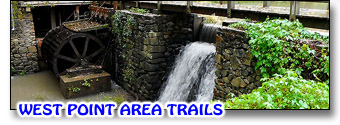
Trails in the WEST POINT AREA are mostly accessed from the parking lot of the West Point on the Eno City Park off Roxboro Road. The Buffalo Trail heads off from the far southwest corner of the parking/roadway area of that park and stops at a small creek that may be difficult to cross after a heavy rain. Straight on, past the creek, is the Sennett Hole Trail which ends up at the Eno River at Sennett's Hole. At that same creek, you can turn right (east) and follow the South River Trail back to the old West Point Mill and dam. On the north side of the river, starting at the steel pedestrian bridge near Roxboro Road, is the Eagle Trail which follows the river most of the way to Guess Road, and cuts uphill to the parking lot of the Eno River Association. Unlike these other trails, the Saw Mill Trail is not part of the city park, and is located on the northwest corner of the Eno River and Guess Road, accessed on Stacy Drive at the Red Steel Gate west of Guess Road. See our separate section on how the Mountains-to-Sea/Laurel Ridge Trail traverses this section. ( * = See Below.)
|
| SAWMILL TRAIL: | NOTE: All trails marked with an asterisk (*) require access to it from another trail. Consult the maps to determine how best to reach this trail, or read the trail description for options and recommended combined trails. Mileages given here ADD to the distance required to access the trail from another. |
|
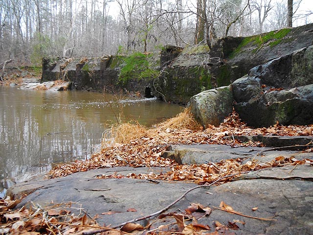
The Saw Mill Trail is one I must urge caution on. I actually enjoy this kind of trail, but it is unblazed, and rather difficult to follow at points. There are trail maps published that show it to be a loop trail but I walked it today (as I write this) and could not find the connector between Open Air Camp Road and Bowling Creek. If you are ONLY trying to do Saw Mill Trail, park on Stacy Drive just west of Guess Road, at the Red Steel Gate. The path is nice and wide at this point and follows a course due south and slightly downhill. In a large clearing, you'll keep to the right and follow an unmarked but fairly obvious path downhill. It will soon vear left and cross Bowling Creek over some rocks. In a good rain, or soon after, the creek will be well-flowing, but there are sufficient rocks to ford it. You stay on the east side of the creek until you find a rickety old wooden bridge. Straight ahead on the same side of the creek is a social trail that hits the Eno River, turns left and goes to the Guess Road Bridge. I find it easier to go under the bridge and up the boulder embankment to the front yard of the Eno River Association headquarters, than try to climb up the west side. and if you continue straight on under the bridge you are now on the MST. Back at that rickety bridge, goover it and head to the Eno River on the west side, and you are still on the Saw Mill Trail... still and will continue to be unblazed (Dec.2011). After you hit the Eno, turn right and the remnants of the old Guess Road Mill Dam (apparently it was a Saw Mill, eh?) is partially in place - the remainder blown away to allow the river to flow freely. At this point, you will be making your own way over rocks and through the brush, as the trail seems to dissappear and reappear at random, but generally following the river. When the Eno starts its gentle turn to the south, an obvious trail heads uphill and swings back ending at Open Camp Road. It seems to end here, as I walked for an hour in the rain and could not find where it continued. Frankly, I would continue along the river following what trail you can find... it seems to peter out not far upriver... and double back. Its a neat trail - unused for the most part, a bit of a challenge being unmarked, but it follows a freakin' river - how lost can you get? I plan someday soon to walk it again, searching for that lost connector, and following it as far upstream as it will go. The north bank has two stretches of private land before it hits the Dunnagan Trail, so it may not go all the way. I'll letcha know if I ever get there.
 |
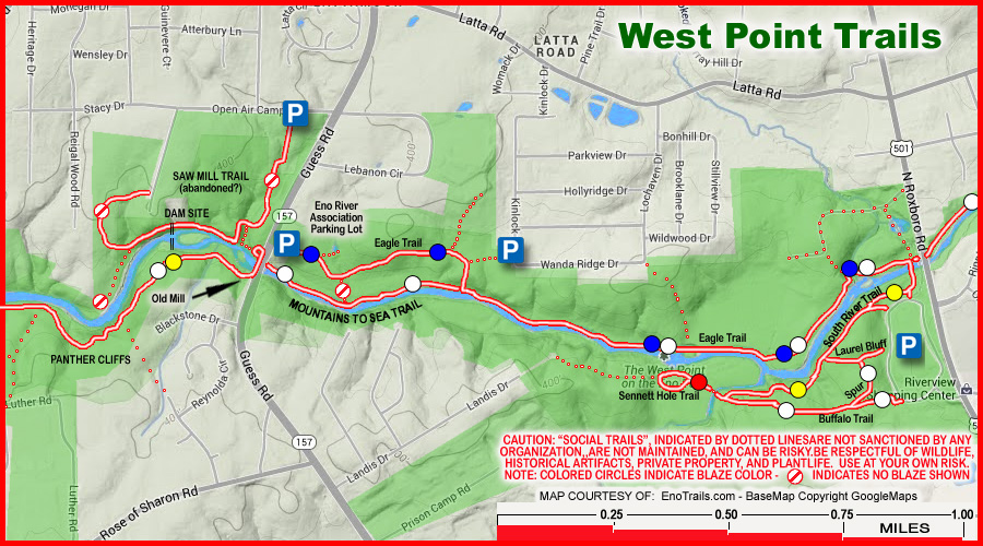 BASEMAP COPYRIGHT GOOGLE MAPS; OVERLAY DATA COPYRIGHT EnoTrails.com RIGHT CLICK & "VIEW IMAGE" or "OPEN IN NEW TAB" TO DISPLAY FOR PRINTING JUST THIS MAP. |
|
|
ver. 3.1 ~ © 2011-
|